
[ad_1]
A red alert has been issued for residents living along a 450km stretch of the West Australian coastline as a tropical cyclone barrels towards land.
Western Australia Premier Mark McGowan says the tropical cyclone bearing down on the state’s coastline is the fiercest of its kind “seen in decades”.
Fast-moving Cyclone Seroja is predicted to bring winds of up to 150km/h when it hits the coast on Sunday afternoon, as emergency services warn residents of impending danger.
WA’s Department of Fire and Emergency issued a red alert for people living along a 450km stretch of the coast between Carnarvon and Kalbarri, warning them their lives and homes are at risk as tropical cyclone Seroja gathers momentum.
Mr McGowan said at a press conference people caught in the red zone were faced with a “very serious threat” and the government expected “significant damage”.
“Tropical Cyclone Seroja is nothing we have seen before in decades,” he said. “People need to act to stay safe.
“Stay inside and shelter in the strongest, safest part of your house or evacuation centre. Keep your emergency kit with you.
“Stay away from doors and windows and keep them closed. Stay indoors until the all clear is given by authorities.”
Anyone in the red alert area is urged to stay inside, activate their emergency alert plan and stay tuned in to updates.
“Now we need that assistance from the community. Stay inside tonight. Don’t even think about coming out until tomorrow,” WA Police commissioner Chris Dawson said.
Category-two cyclone Seroja is expected to bring damaging 155km/h winds, heavy rain, abnormally high tides, and coastal flooding, sparking fears dozens of homes are at risk of going under water.
Winds gusts could top 125km/h as far inland as the northern wheatbelt, with Seroja expected to move at a rate of 50km/h when it hits dry land.
The howling winds are expected to hit Esperance from the west at 100km/h.
People in the Kalbarri and Geraldton area can expect to feel the impact of the system from mid to late afternoon on Sunday.
Residents in the low lying areas of Denham could become inundated with water as the weather system approaches.
The Bureau of Meteorology has warned Denham and Geraldton face the worst conditions, which could last for up to three hours.
“Tropical Cyclone Seroja is expected to cross the coast as a Category two system on Sunday evening,” it said in a statement.
“The area at greatest risk is from Denham to Geraldton. Coastal communities and adjacent inland areas between Carnarvon and Lancelin are urged to monitor weather warnings on the Bureau’s website and BOM Weather app, and be prepared to take action.
“Destructive wind gusts of up to 150km/h are expected close to the centre of Tropical Cyclone Seroja as it crosses the coast. The most likely area to experience destructive wind gusts is on the coast from Denham to Geraldton.
“Wind gusts of this strength are very rare for the Central West coast. Winds up to 150 km/h can may cause damage to homes, sheds and significant damage to caravans, trees and increase the risk of power failure.”
The cyclone was upgraded to a category-three storm but is expected to reduce to category two before it makes landfall.
“Seroja is expected to intensify a little during Sunday, possibly reaching severe category-three intensity as it accelerates southeast towards the coast,” the BOM said.
“It is then forecast to weaken back to category two before it crosses the coast.
“The cyclone should weaken (again) as it moves inland on Monday but is still likely to be causing gusty winds east and north of the track, and heavy rain close to the track, as it crosses over the south of the state.”
There are several alerts in place including a yellow alert for people between Carnarvon and Kalbarri – not including Kalbarri town site.
“(They) need to take action and get ready to shelter from a cyclone,” the bureau said.
A blue alert was issued for residents near Cape Cuvier and Lancelin, and inland areas within the Shires of Northampton including Chapman Valley, Morawa, Greater Geraldton, Mingenew, Three Springs, Perenjori and the towns of Mullewa, Coorow and Carnamah.
The BOM said locals “need to prepare for cyclonic weather”, which involves organising food and water supplies, an emergency first aid kit, and portable torches and radios.
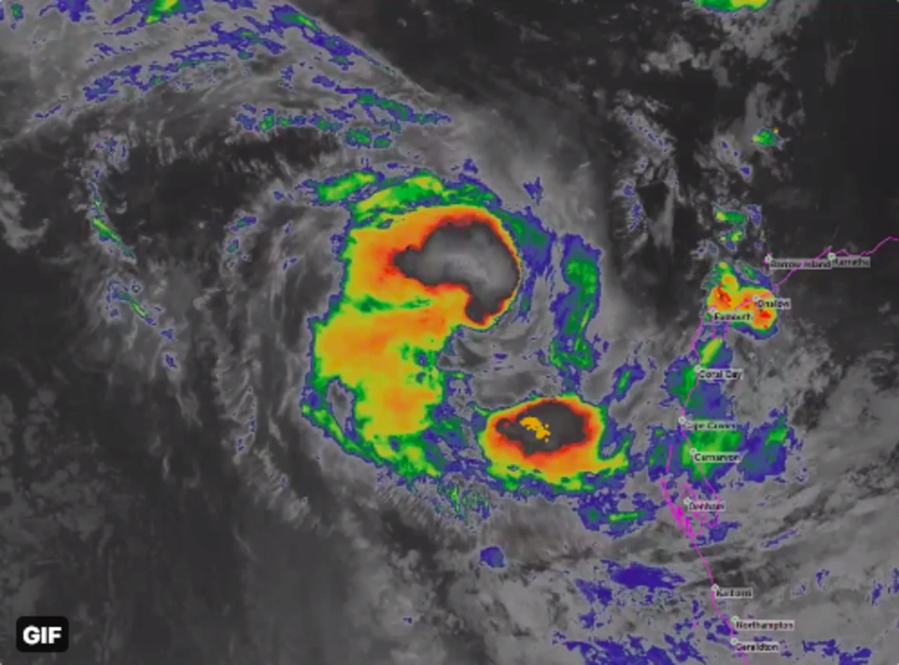
The cyclone event off the WA coast threatened to produce two systems.
Odette, originally a tropical low, formed into a tropical cyclone after the two systems circled each other over the Indian Ocean on Thursday.
This is known as the Fujiwhara effect.
Odette was downgraded to an ex-tropical cyclone by the Bureau of Meteorology on Saturday.
“Ex-Tropical Cyclone Odette has weakened and poses no threat of gales to the Western Australia coastline, although Tropical Cyclone Seroja is still active,” BOM said.
Both were forecast to make their way down the coast during the weekend but only Seroja was expected to make landfall.
Meteorologist Todd Smith said the interaction between the two systems earlier this week was very unusual as it had not been seen off the WA coast for decades.
“The last time a cyclone affected the Geraldton area was 1990, and even that was a weak tropical cyclone below intensity,” Mr Smith said.
[ad_2]
Source link