[ad_1]
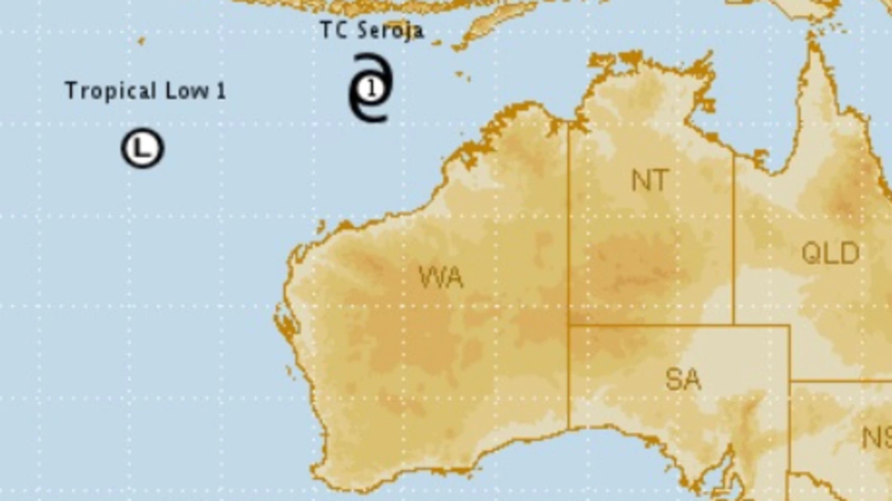
A tropical cyclone and a tropical low off the West Australian coast are together expected to create a phenomenon known as the Fujiwhara effect.
Tropical Cyclone Seroja and another tropical low off the coast of Western Australia are together expected to bring heavy rain to the state’s north this week.
When tropical systems get close they often rotate around each other, which is known as the Fujiwhara effect.
“The Fujiwhara effect can make forecasting track and intensity more challenging, as a number of scenarios can occur with one system often becoming more dominant,” the Bureau of Meteorology said in a statement.
“On rare occasions, the two systems can combine into one, though this is not expected with these two systems.”
Tropical Cyclone Seroja may reach category 3 intensity, while the tropical low is expected to strengthen and could reach cyclone intensity from late Thursday.
Both are expected to stay offshore over the next couple of days but will bring rain and possibly strong winds to the state’s northwest from late Thursday.
People between Onslow and Coral Bay, including tourism hub Exmouth, are urged to be prepared.
Some rain is also expected in the south of the state during the rest of the week, according to the bureau.
In its latest update on Wednesday morning, the bureau said Tropical Cyclone Seroja was a category 1 and about 690km northwest of Broome, moving southwest at 19km/h.
It is forecast to intensify towards the end of the week.
“On Sunday, it is expected to turn to the southeast, towards the west coast, and make landfall most likely later (on) Sunday or Monday,” the bureau said.
The tropical low is about 660km south of Christmas Island and moving slowly.
[ad_2]
Source link