
[ad_1]
A tropical cyclone and two other dangerous weather systems are looming off the West Australian coast, with travellers warned to flee the area.
Tourists holidaying in Western Australia’s north have been warned to leave the area as the state prepares for fierce storms caused by Tropical Cyclone Seroja and potentially a second cyclone.
Flash flooding, intense winds and heavy rainfall are expected during the weekend in parts of the state.
People between Onslow and Perth are urged to prepare for tough weather conditions, with dangerous surf and a storm surge making the ocean treacherous, the Bureau of Meteorology warns.
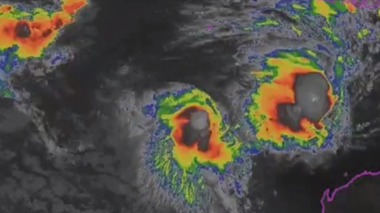
“The reason such a large part of Western Australia is expected to be affected is because two tropical systems are expected to approach WA’s coast at different times,” the bureau said in a statement on Thursday.
The first is from a tropical low that could bring heavy rain and gale force winds to the Exmouth area on Saturday night.
If the tropical low intensifies to category 1 by Friday, it will be named Tropical Cyclone Odette.
Emergency Services assistant commissioner Paul Ryan said people holidaying in the Exmouth area should consider leaving the area now.
“If you remain in the area in a tent or caravan you’re at risk,” he told reporters.
Late on Sunday or on Monday, Tropical Cyclone Seroja is expected to cross the coast as a category 2 or 3.
It is most likely to bring destructive winds with gusts of about 150km/h and intense rainfall between Carnarvon and Jurien Bay.
“Heavy rain and damaging winds are expected to continue inland through the Wheatbelt on Monday,” the bureau said.
“Tropical Cyclone Seroja is forecast to be travelling very fast so the worst conditions at any location will last from three six hours.
“While a direct impact to Perth is unlikely, a period of heavy rain and strong easterly winds is possible.”
A second tropical low is also looming near the Cocos Islands.
Bureau of Meteorology senior meteorologist James Ashley said three powerful systems developing at the same time was “extremely uncommon”.
“I’ve been working here in Perth for over 20 years and I’ve never seen us have three systems so close to being cyclones or being cyclones at the one time,” he told reporters.
“Generally, cyclones tend to need a bit of space between them so they don’t mess each other’s inflow and winds and moisture feeds and things like that.”
It is unusual for a tropical cyclone to cross the coast south of Carnarvon, but the bureau has indicated the Fuijiwhara effect, which is the interaction between the tropical low and Tropical Cyclone Seroja, is a factor.
“Cyclones that form in April in the western region typically have a greater chance of moving south out of tropical regions,” the bureau said.
Higher than normal tides are also expected along the west coast.
Significant storm surge is expected closer to where the system tracks and could exceed highest astronomical tide, the bureau added.
[ad_2]
Source link