
[ad_1]
Residents in Western Australia are being warned to take shelter now as a tropical cyclone nears the coast.
A category-two cyclone looms off the West Australian coast and residents have been told to take shelter now.
Tropical Cyclone Seroja is expected to bring damaging 155km/h winds, heavy rain, abnormally high tides, and coastal flooding, sparking fears dozens of homes are at risk of going under water.
Residents from Carnarvon to Kalbarri are being urged to take action immediately while residents in the low lying areas of Denham could become inundated with water as the weather system approaches.
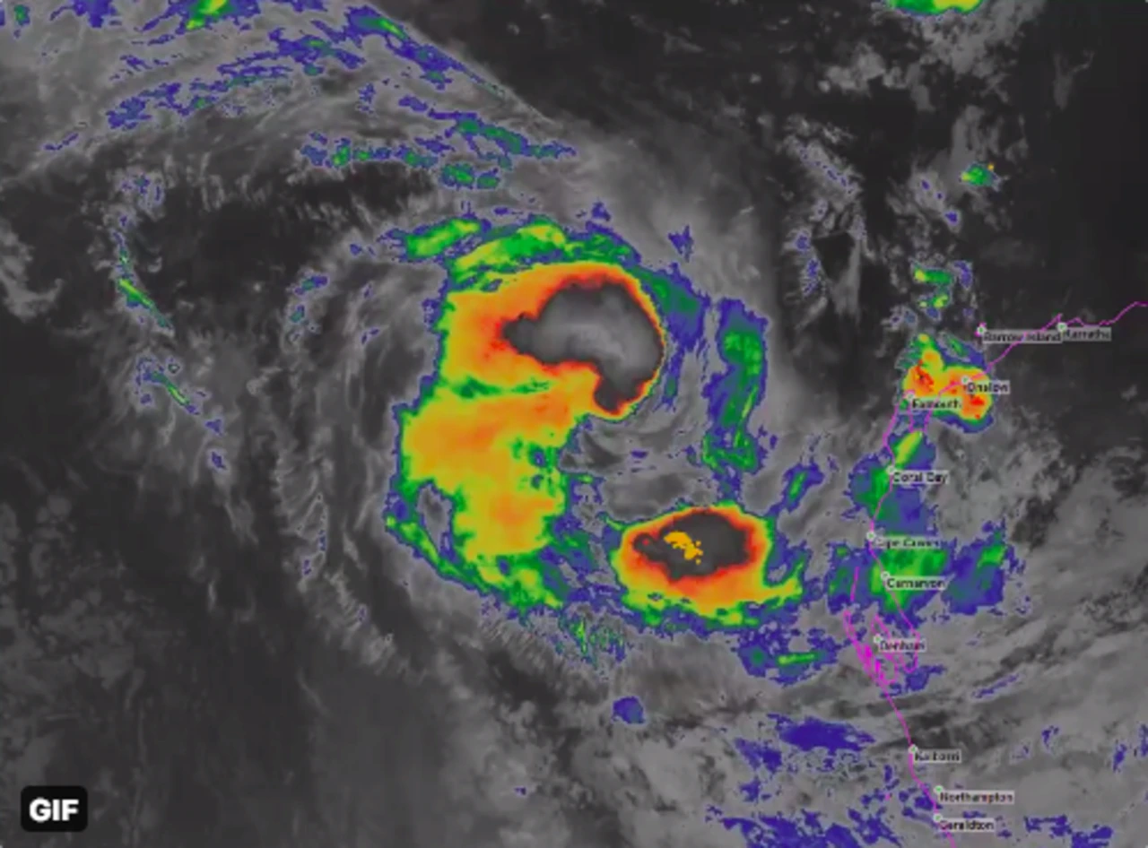
The Bureau of Meteorology said the cyclone had intensified to a category-two system and could reach category-three severity before it makes landfall.
Tropical Cyclone Seroja is tracking towards the state’s southeast.
“Seroja is expected to intensify a little during Sunday, possibly reaching severe category-three intensity as it accelerates southeast towards the coast,” BOM said.
“It is then forecast to weaken back to category two before it crosses the coast.
“The cyclone should weaken (again) as it moves inland on Monday but is still likely to be causing gusty winds east and north of the track, and heavy rain close to the track, as it crosses over the south of the state.”
There are several alerts in place including a yellow alert for people between Carnarvon and Kalbarri – not including Kalbarri town site.
“(They) need to take action and get ready to shelter from a cyclone,” the bureau said.
A blue alert was issued for residents near Cape Cuvier and Lancelin, and inland areas within the Shires of Northampton including Chapman Valley, Morawa, Greater Geraldton, Mingenew, Three Springs, Perenjori and the towns of Mullewa, Coorow and Carnamah.
The BOM said locals “need to prepare for cyclonic weather”, which involves organising food and water supplies, an emergency first aid kit, and portable torches and radios.
The cyclone event off the WA coast threatened to produce two systems.
Odette, originally a tropical low, formed into a tropical cyclone after the two systems circled each other over the Indian Ocean on Thursday.
This is known as the Fujiwhara effect.
Odette was downgraded to an ex-tropical cyclone by the Bureau of Meteorology on Saturday.
“Ex-Tropical Cyclone Odette has weakened and poses no threat of gales to the Western Australia coastline, although Tropical Cyclone Seroja is still active,” BOM said.
Both were forecast to make their way down the coast during the weekend but only Seroja was expected to make landfall.
Meteorologist Todd Smith said the interaction between the two systems earlier this week was very unusual as it had not been seen off the WA coast for decades.
“The last time a cyclone affected the Geraldton area was 1990, and even that was a weak tropical cyclone below intensity,” Mr Smith said.
[ad_2]
Source link